Open Source Geoinformatics
About Us
Resocatec is a geoinformatics software company based in Annapolis, Maryland. We specialize in spatial demographic analysis, deployed via free and open source (Foss4G) technology. Though we have plenty of experience developing and implementing industry-standard Esri based geospatial solutions, as well.
Our mission is to put YOU in charge of your software needs, not the vendors.

Why Open Source Geoinformatics?
No license fees.
Unlimited users.
Standards based.
Vendor independence.
Our Services
Resocatec is a dedicated geospatial consulting firm. We guide clients throughout their project life-cycle; identifying nimble and economic software solutions, data acquisition, spatial data library implementation, web-based and desktop user experiences, and finally definitive geospatial results. We work with federal, state, local governments and private commercial clients. Our expertise lies within the following:
Consultation/Solution Development
Geospatial Software Architecture
Data Development & Analysis
Installation & Set-up
Support

CALIFORNIA CASE STUDY
Resocatec was contracted by the State of California to develop a web-based interactive mapping tool that allows participants to draft and submit Community of Interest delineations to the California Citizens Redistricting Commission. A Community of Interest, as mandated by the California Constitution, is an important building block in the decennial redistricting process. Communities of Interest allow citizens to identity their common geography (e.g. population area, economic activities, trade and social interactions) — insuring communities are included whole within single districts for effective and fair representation.
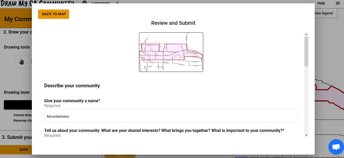
Our solution, an interactive open source map titled Draw My CA Community (featured in the images below), offers guests and registered users the means to delineate their community. Built upon nested Census boundary geography (i.e. County, City, Tribal Area, Tract, Block) — citizens first specify the name of their community and then interactively “draw” their Community of Interest by selecting Census statistical area geography at their chosen scale.
Figure 1. Screenshot of the Draw My CA Community web-based mapping tool.
Seamless open source base geography, cloud storage of delineations and Census data libraries reduces the costs, data management, facilities and personnel clutter that may otherwise have been required of the Commission.
Citizens choose from several drawing tool options to interactively select their Census geography and finalize their submission (Figures 2, 3, 4, 5 below).
Figure 2. Choosing the Census statistical area geography that will be used as the source drawing layer.
Figure 3. The lasso drawing tool in operation (see the blue outline within the map image, with Census Block geography).
Figure 4. Submitting one’s Community of Interest delineation.
Figure 5. The review window.


